April 25, 2026: Severe Weather Strikes Western North Texas
- nsprabary
- Apr 29
- 2 min read

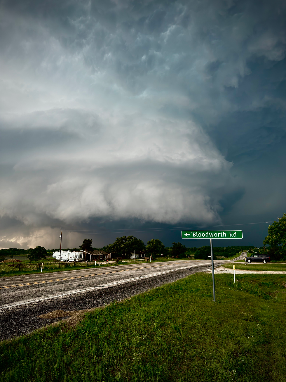
April 25, 2026 turned into one of the most dangerous severe weather nights western North Texas has seen this spring. What began as a warm, unstable afternoon quickly evolved into a serious nighttime severe weather event, producing damaging tornadoes, destructive hail, and widespread wind damage across parts of Wise and Parker County.
By late afternoon, the atmosphere had become increasingly unstable across western North Texas. Strong daytime heating, abundant moisture, and a strengthening lower level jet created an environment favorable for rotating supercells. As evening approached, storms began developing Northwest of the Metroplex near Windthorst and quickly intensified.
The most serious damage occurred near Runaway Bay, where a tornado later received an EF-2 rating with estimated winds near 135 mph. Several homes suffered major damage, roofs were torn away, vehicles were tossed, and entire neighborhoods were left dealing with heavy debris. Families were displaced, and emergency crews worked through the night responding to damaged structures and blocked roads.
Further south near Springtown, another tornado developed and was rated EF-1. While not as intense as the Runaway Bay tornado, it still caused significant damage to trees, power lines, and homes. Utility crews spent hours restoring power while residents cleaned up fallen limbs, damaged fences, and roof damage caused by both wind and hail. The velocity couplet at this time was the biggest i had ever seen on radar.
Large hail was another major part of this event. Some locations reported hail reaching golf ball to baseball size, causing broken windows, vehicle damage, and roof impacts across several communities. Straight-line winds also added to the destruction, especially as storms began transitioning after dark.
One reason this event became especially dangerous was timing. Severe storms after sunset always increase risk because visibility drops and many people underestimate how quickly conditions can worsen. On this night, the main storm kept back building and performed strange behavior throughout its life cycle.
From a storm structure standpoint, this was a classic North Texas severe weather setup: strong instability, increasing low-level shear, and isolated storms that were able to remain discrete long enough to produce tornadoes. The main supercell remained severe for for approximately 10 hours.
For storm chasers, April 25 was a reminder that western North Texas can produce serious nighttime severe weather quickly when ingredients align. For local communities, it was another reminder of how important it is to stay weather aware, especially during spring when dangerous storms can develop late in the day and continue after dark.
At Apex Storm Tours, nights like this are why understanding storm behavior matters. Severe weather is powerful, unpredictable, and deserves respect every single time. It wasn't an easy chase with erratic storm behavior at times and high precip storm mode to deal with. It's definitely one that will be remembered for a long time.
Comments